

Sary-Jaz gorge

Longitude: 78°57'15"

Sary-Jaz gorge (from Kyrgyz Sary-Jaz, meaning "Yellow spring") is a gorge in Kyrgyzstan, in the Issyk-Kul region, about 50 km east of the city of Karakol. Sary-Jaz is part of the Turgen-Aksu Gorge, which in turn belongs to the Terskey Ala-Too mountain system.
Questions, additions to the article, and comments about visiting the gorge can be left on the discussion page.
Gorge geography
Sary-Jaz gorge is located in the Terskey Ala-Too mountain system in the eastern part of the Issyk-Kul region, about 50 km from the regional administrative center, Karakol. It is adjacent to Turgen-Aksu gorge.
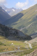
The valley stretches for about 12 km from west to east toward the Chon-Ashu Pass. The elevation near the conditional entrance to the gorge is about 2,850 meters, while the pass at the upper end of the gorge reaches about 3,800 meters above sea level. The total elevation difference is therefore roughly one kilometer.
The surrounding mountains rise to about 4,000 meters. A small river flows along the gorge. A notable feature of the area is a group of small alpine lakes that formed in the valley between the mountain slopes. They lie at an elevation of about 3,600-3,800 meters. The gorge is also characterized by the absence of forests and lush vegetation.
Tourist route

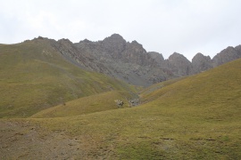
The route through Sary-Jaz is interesting because it passes directly through the valley of Turgen-Aksu gorge, where visitors can see the surrounding mountains, cliffs, forests and highland scenery. Sary-Jaz is especially attractive for its numerous small lakes located among mountain peaks at an altitude of 3,600-3,800 meters above sea level. Local residents conventionally call them Jash-Kol (Kyrgyz: Жаш-Көл, "young lakes"). One of the nearest lakes is shown in the photo gallery and marked on the gorge scheme.
Reaching these lakes can be difficult for physically unprepared visitors. Local residents may offer horses for a small fee, which makes it possible to reach some of these unusual places. Not all lakes are close to the main road along the gorge. The nearest lake is about 1,800 meters from the road, but because of the steep elevation gain, the walk to it usually takes about 3-3.5 hours. In general, routes to some of the lakes can also be unsafe, so hikes should be made in a group with a guide who knows the safer approaches.
During a hike to the lakes, especially in August, visitors may experience what is sometimes described as "four seasons" in one day: summer weather when the sky is clear and warm, spring or autumn conditions with clouds and changing colors higher up the slope, and even snowfall. Such changes can occur several times during the day, so warm clothing and suitable footwear should be prepared in advance.
How to get there
The route to Sary-Jaz passes through the valley of Turgen-Aksu gorge, which is located about 40 km east of Karakol. From the city, the road goes toward the village of Ak-Bulun, then turns into Turgen-Aksu gorge and continues to Sary-Jaz gorge and onward to the Chon-Ashu Pass in the direction of the Enilchek valley.
Gorge photo gallery
- Photos of Sary-Jaz gorge
-
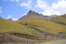
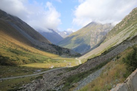 Western part of the gorge
 -
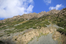 Cliffs on the northern slopes
 -
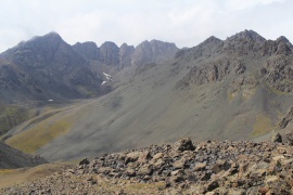
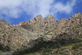 Mountain ridges of Sary-Jaz
 -
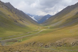
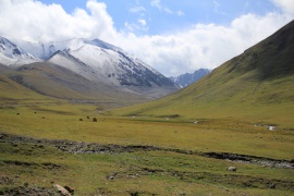 Gorge valley
 -
 On the way to the alpine lakes
 -
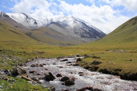 A river flowing along the gorge
 -
 Valley panorama
 -
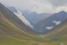 The gorge in clouds
 -
 Path to the alpine lakes
 -
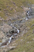 Stream
 -
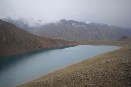 One of the alpine lakes in the gorge
 -
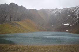 Lake at an elevation of about 3,800 meters
 -
 Sary-Jaz
 -
 View of the gorge from one of the summits


Note
This destination is not very popular among tourists, but some travel companies organize tours to the gorge and offer guided hikes to one of the alpine lakes. Overall, such a trip can leave strong impressions and lasting memories. Visitors can discuss the place and share their impressions on the discussion page.